The magnificent navigation markers on the ICW help birds onto the property ladder. The Americas use can shapes for green and cone/triangle shapes for red. The opposite of Europe -(the IALA A/IALA B system) I used to remember the European buoyage by thinking of red cans of tomato soup... ah well, my other mnemonic of "Is there even any red port left" sort of works - the americas put red on the right returning to port...(and on the left leaving of course). We put port on the left on the way into harbours - unless contradicted by the symbol for bouyage direction shown on small scale charts... confused yet?
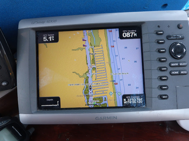
The wee pictures on the chart plotter or your mobile phone tell you were to go...
And so to exit the ICW - the last bridge is a lift bridge - another new one for me (though of course we had seen many on the Gota/Trollehattan canal when crossing Swedan) Actually the shot shows a single Bascule lift bridge in front of the lift bridge - there are often two bridges togeter on the ICW - the lift bridge is for the railway and kept in the open position unless there is a train coming, in which case you go by the red and green lights. For the lift bridge I call up the bridge operator on channel 13 (most of the ICW uses channel 9 so you need to know which to use) Also it is important to get the name of the bridge right or the bridge behind you might get opened by mistake. They don't have signs apart from height guages so you need a pilot. There's an app for that of course - Active Captain(AC) has crowd sourced data on anchorages, marinas, shoals and bridges - a superb resource as it includes prices, navigation instructions, phone numbers and web addresses as well as dated reviews. All held in the fog but it downloads to your phone automatically. By the way I have started calling the internet cloud the fog as I can never remember where I have put stuff (I pay a couple of bucks a month to keep all my data "out there" somewhere.)
<<< map of ICW >>>
My ICW adventure has been 1,243 miles long and I have really enjoyed it. I had 5 or so excursions outside the ICW as I came up the coast but that was ok, the bulk of it was "inside". It gave me some experience of small town America and very pleasant that has been. It also opened my eyes to the wonderful nature and scenery found here, and the vast amount of waterways - not just the ICW but the numerous rivers and channels I crossed, the lakes I traversed and usually you were on your own, fair enough there are hundreds of thousands of waterside properties, but America is a big place. The overriding impression is of space. Many watersides were banked with sand which made for more pleasent viewing than mud. No litter either, no floating plastic bags or coke bottles. And the vast numbers of pump out stations for boaters mean no sewage - no shit. To be fair parts were tedious, parts were shallow and that was stressful but no-one said life was wonderful all the time. I was glad to have done it, I would do it again. (and may have to when I come down the coast in the Autumn, the weather in October and November will be less kind!)
So, I pass mile marker zero and enter a conglomeration of small towns - Portsmouth on the left, Norfolk on the right and Hampton Roads in front (slightly to the left). A meeting of rivers at the bottom of the Chesapeake bay. I wanted to see the bay as it is reputed to be superb cruising ground - and so I find it to be. Over a hundred miles long with many rivers branching into it - with the rivers also being nice to cruise up. The Potomac runs up to Washington and further up the Chesapaeake we find Annapolis and the Patapsco river that runs up to Baltimore. I resolve to put the boat in Annaopolis and get the greyhound bus to Washington to meet Shirley who flies in late on the 9th July - she has booked a hotel for a couple of days and so we will "do" Washington from there before returning to the boat and crusing up to Balitmore. The alternative would have been a 95 mile motor up the Potamac and then a 95 motor back down the Potomac - time best spent on the Patapsco and Chesapeake.
Maps courtesy of openseamap.org
In fact here is an overview of the Chesapeake bay
I anchor for free off Hospital point in an area that the town has buoyed off. It is certainly central to everywhere I stay a week, some days I am the only boat, some days there are 4 others, room for lots more - the town park in Norfolk has many open air concerts and events - one gets evacuated within 15 minutes one evening at 7 pm due to an incoming thunderstorm - when it arrives 30 minutes later the wind in the anchorage rises from the normal idyllic 0-10 knots up to 40 knots and the rain reduces visibility to a few hundred yards. I get this a couple of nights - as well as massive lightning. The wind only appears about 25% of the time. Towards the end of my week here there is a rather nice jazz concert, the concerts finish well before 10 so sleep is easy... here is a video of the concert - note there is a lightning blast a few seconds in but luckily it is far away. My second week in Norfolk gets no thunderstorms as they had moved North and West by then I think. I do get extreme heat though.
The town of Portsmouth on the West side of me is quite small, it has a historic district with many nice houses, there is also a large number of churches. Built in brick. Portsmouth did have a massive fire in its history so brick is best maybe?
Many religious groups came to America to avoid persecution or to improve their lot - sometimes to different states within the original 13 so you get clusters of different faiths, but then they spread interstate and perhaps this is why there are so many churches in many of the American towns.
So many that perhaps the compete for trade?
I also liked the public library here -
But my favourite building is the cinema - built in 1943 and protected as a historic building, inside there are luxury tables and velvet chairs and they serve food. Each table has its own telephone and you can order what you want. Felt more like a jazz club with a stage. I had nachos and beer but the steak and fries looked impressive. There were only five of us when they could seat a hundred. I learn later that two of the other four were OCC British yachtspeople though unfortunately I don't get to meet them.
(The film I saw was Solo which I liked a lot despite it getting poor reviews)
The other draw of Portsmouth was a lightship museum (the town also had a naval museum which was unfortunately closed for renovation). Lightships interest me as before I left Ireland I had visited the Down Cruising Club which is based in a floating lightship in Strangford Lough. I had got application forms to join but didn't quite get around to it before leaving - I wanted to give them my fees to support their maintenance of the ship which is in superb nick - it has a captains cabin kept as was and well worthy of a visit. I also had ulterior motives for joining as it would be kinda cool to run a ham radio statio from the lightship - there is a "Lighthouses and Lightships on the air" weekend every August which I may try for in a couple of years when I get home! So I was keen to visit the Portsmouth (VA) one.
I have to say that the interior was actually rather spartan. This ship has an engine and only two anchors. 9 crew and two officers too - I think the Irish ones have no engine, four anchors and only 3 crew - the Irish one more a floating lighthouse than a ship.
These cabins are for the officers, the crew had a room with three triple bunk beds.
My guide did tell an interesting (though horrible) story of a ship splitting the Nantucket Lightship in two, with loss of life I am sorry to say. I have roared down the Irish sea in thick fog - and fast currents and recall hearing the South rock fog signal not on the horizon but high above me - before I had to turn sharp left when it loomed about 20 feet away. Ghostly. Adrenaline is brown coloured.
Artists impression.
In this lightship the mast holding the old parafin lamp up is hollow and you had to climb up inside to replenish the parafin reservoir every few hours. It got replaced with electric lights eventually.
I like their mud mushroom anchor.
I was visited at anchor by mother duck and her offspring, amazing to find so much nature in urban surroundings - though to be fair there are lots of parks about and the towns are actually very small.
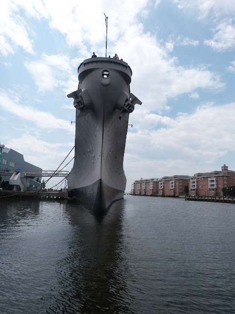
The main acreage is given over to the Navy, they have the Wisconsin nearby in Norfolk (the river is less than a mile wide). Open to visitors but still on he register and could be pulled into active service theoretically. (did you see the film Battleship?)
a bit skinny
I got the ferry over to Norfolk for 2 dollars as I had arranged to meet Greta Gustavson and Gary Naigle - they are the Ocean Cruising Club Port Captains for Norfolk and, as I had joined the OCC I needed to buy a burgee. Greta organises this for the states as she runs an embroidery company.
The ferry is rather twee.
Greta and Gary offer their own dock free to OCC members, unfortunately the entire condo's docks were getting rebuilt and the docks were closed. It is kind of them to do this for OCC members and they both take the role of Port Captain to their hearts, they invited me into their home, gave me cold beer and than took me out for a meal. I hope I can recipricate when I return. A lovely couple that do the OCC proud. Gary was also able to advise me on a yard that can lift Shadowmere out to get worked on - a yard that allows DIY and also liveaboard on the hard, many don't. So I resolve to go there - to Cobb's Marina in Little Creek about 20 miles away.
On leaving Hospital point anchorahe - just beside Tidewater Yacht Marina where I had parked my dinghy, showered my body, washed my clothes and Wified my laptop!
The 20 miles around to Little Creek involved passing many many naval docks , over a dozen, I can probably only tell you how many if I kill you afterwards. Likewise the photographs below were not taken by me. My camera just sort of clicked and clunked as I went past.
I had to watch myself as there were three of these rather nifty patrol boats about -
I was too scared to take a more frontal photograph. They moved rather fast too!
The shipping channel into Chesapeake is busy - two of the biggest East coast ports are here - Baltimore and Norfolk. I saw a container barge being towed, I doubt if this could stop in a hurry!
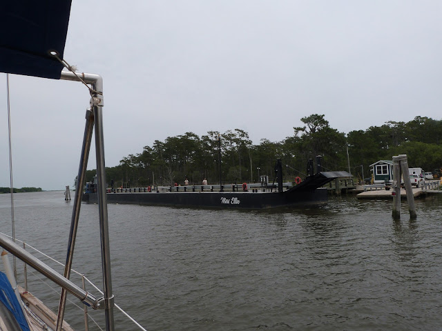
I had coped with three tugs pushing barges on the ICW, when I say coped, I ran Shadowmere into the shallows and cowered there until they went past. Luckily I met this fellow when I had a wide channel.
Mind you there were a few boats about transmitting AIS (Automatic Identification System). Probably not most of the navy ships as they switch theirs off...
The entrance to Little creek was tight with a knot or two of tide with me - I had a landing craft come in behind me as a lot of the creek is taken up with the "Little Creek Expeditionary Force" and I saw half a dozen landing craft. moored inside on their dock.
And here is Shadowmere with her new bottom all painted with antifouling. I also replaced the shaft anodes and rudder packing as well as waxing her hull sides. Despite the heat during the week. It is here that I learn of the humindex and the heat index that the Canadians and US use. A combination of high temperatures and high humidity is dangerous as the body cannot lose heat by sweating. I drink over 4 litres of water a day and only pee half a litre (I measured it- I am an engineer after all) so I know I sweated plenty, I was still too hot.
The coastguard issue extreme heat warnings and I look up the heat index and humindex ratings, it is in the "Danger" zone but not the "Extreme Danger zone" (Humindex of 43, heat factor of 110+ ) If I was an employer I am supposed to allow frequent rests, reschedule work to cooler parts of the day and keep people in shade (without shade you add 15 degrees F to the tables).
I feel justified in doing little for most of the day and working early morning until 9am and from 6pm until 8:30pm. The temperature in the aft cabin hits 44 degrees Centigrade although the main cabin only gets to 37. My strategy is wait until some sweat gushes out. Sit under a fan and delight in 2 to 3 minutes of cooling. Then switch the fans off as they push unpleasant hot air across my dry skin. Wait a few minutes until I gush sweat again and repeat. Seems to work! Thank goodness for a working fridge - cold water with powdered tea added to it helps.
I can get automated weather forecasts on my ham radio and also must monitor the National Hurricane Centre website (which will also come through on the radio but the early I find out about weather the better.)
How about this;
...EXCESSIVE HEAT WARNING REMAINS IN EFFECT UNTIL 9 PM EDT THIS
EVENING...
...HEAT ADVISORY REMAINS IN EFFECT FROM 9 PM THIS EVENING TO 9 PM
EDT THURSDAY...

* TEMPERATURE...Highs in the middle 90s combined with high
  humidity will yield peak heat index values near 110 today and
  105 Thursday.
* IMPACTS...Heat related illnesses such as heat exhaustion and
  heat stroke will be possible. People most vulnerable include
  those who are spending lots of time outdoors...those who do
  not have air conditioning...young children...the elderly...and
  those with chronic ailments.

PRECAUTIONARY/PREPAREDNESS ACTIONS...

An Excessive Heat Warning means that a prolonged period of
dangerously hot temperatures will occur. The hot temperatures
will create a dangerous situation in which heat illnesses are
likely. Drink plenty of fluids...stay in an air-conditioned
room...stay out of the sun...and check up on relatives and
neighbors.
And if the heat is not enough there is trouble looming in the Atlantic
A (possible),mere tropical depression but I need to watch it.
Anyway, after launch I head north 30 mile to anchor in Godfrey bay in Plantakank River andf then onwards the next moring to Smith Creek just off the Potamac River. Delightful places and I just love the names of these rivers!


