
John Henshaw and I depart Key Largo for Miami - I have DVDs on board of CSI Miami and we watch these instead of reading proper guides…
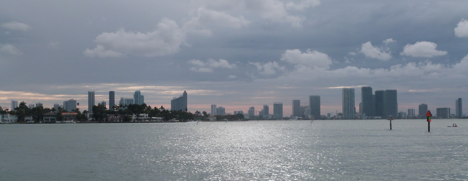
Entrance by Sea is fairly amazing – a big long ship channel with skyscrapers each side. The entrance is called the Government Cut and is blocked to pleasure craft if there are Cruise liners in port. Luckily they had all left when we arrived (they leave at 6pm in most places). When we leave Miami we are diverted from Government cut to a nearby side channel South of the cut but this only adds an extra half mile to the journey.
Miami, or more correctly Miami Beach is fairly amazing – to anchor a yacht in the heart of a city. In fact there is water everywhere – there are channels and artificial islands with buildings on them, docks are everywhere – a theme we find in Florida.

We took the yellow track on the way in. Each of the rounded rectangles have houses, each with their own docks. Usually powerboats – dictated by the very shallow waters. We had to creep in slowly with Shadowmere as she has over a six foot draft.
Some shots of our anchorage


There are a lot of paddle boarders. Kayaks and a couple “walking across the water on these…
Maybe these will catch on in Belfast… better than going up the Lagan in a bubble.

The next day we go shopping – by dinghy, there is are small canals running through the city

On Sunday we walk across to the Miami Beach, the beachfront is a boardwalk, backed by large number of exclusive hotels – they have pools and seating areas but you need keycodes to access them. Being early on Sunday it is all a bit subdued.

A lovely old church (Synagogue)


The Miami Convention centre is a massive building, maybe the facades had Irma damage

I should explain what the ICW is and how it will feature in our travels; The IntraCoastal Waterway is a web of channels and rivers that allow passage from Norfolk Virginia to Miami and beyond. The Miami to Norfolk route is 1088 Statute (land) Miles to Key West it is 1243 miles. There is also a versoion of the ICW that runs West along the gulf coast but it has lower bridges and does not suit sailboats. In fact depths from Miami tp Key West don’t suit big sailboats either but From Miami to Norfolk the bridges have an airdraft of 65 feet or open on request (there are 88 bridges in total) The depth of water varies but is meant to be 10 or 12 feet. Georgia only manages that when the tide is in however. Florida spends a lot of money on upkeep, Georgia relies on Federal funds. (Florida levies a tax on all waterside properties – and there are a lot of these!
When I said there is a 65 foot lower limit from Miami to Norfolk, there is one exception. The Julie Tuttle bridge has a clearance of 55 feet. Shadowmere needs 59 feet. Hence we go “outside” on our first part of the ICW – In fact we go outside a few times to allow sailing as most of the ICW has to be motored.
I am looking forward to doing the ICW, the scenery and small towns offer an insight into America you could not get any other way.
Anyway, bridges!

The ICW is also well marked with red and green numbered triangles and special pilot books to guide you – and give the name and procedure for each bridge - some are timed openings and some are on request with rush hour traffic having priority. I have small scale paper charts from Key West to Canada and three types of electronic charts – the Garmin Chartplotter, Navionic charts on my UK phone and the American NOAA charts on my US phone and laptop. There is also an excellent app(and website) called Active Captain that has crowd sourced data on marinas and anchorages on the ICW and surrounding areas, as well as reports of shoaling, missing marks and user reviews. Most excellent resource! Dave and Mary from Wandering Rose that we met in Havana have also given me a paper book ;Skipper Bob’s”Anchorages along the ICW”. Even so without small scale charts I have to do my homework and look ahead to plan what to watch out for.
Because of the Julie Tuttle bridge, John and I exit Miami back onto the open sea and have a pleasant sail to Fort Lauderdale – and from there onwards to Palm Beach (Lake Worth) and then onto Fort Pierce before going “inside” and up the ICW. This is a good strategy as we miss a very high density of opening bridges. We also go outside from St Augustine to almost Brunswick – just to have a sail.
We arrive in Fort Lauderdale as it starts to rain, and rain, and rain. Joined up thunderstorms for two days. We manage to anchor in a small lagoon called Lake Sylvie, it is surrounded by private housing each with their own private dock and no public access whatsoever. However the rain keeps us below anyway. And two days later we leave and head back out to sea.
To give you an insight into how rich people get their houses built here look at the chart below, the dreged channles are to ensure everyone gets their own dock. (Key Largo was like this too)

Our route in and out is in yellow again
Here are some google Earth screendumps too.


Big boats!
We leave Lauderdale and go 57 miles up the coast to Palm Beach also known as Lake Worth –
We pass a towboat towing a small boat - the TOWBOATUS company offers a service like the AA. I heard a superyacht call one up to help it into their berth - they had "gold" coverage. Normal fees are about 250 USD a year and since a tow without membership would cost 4 figure sums it might be worth it - if you only have one method of propulsion. I am a bit put out when I hear a yacht call for a tow when their engine stops - and they are out in the open sea with no wind "the sails are just slopping about". Why don't they wait for wind, or anchor!

Anyway, our outside passage has enough wind for us. (the yacht was 20 miles south of us, 3 miles offshore)
Google Earth shows the inside route is just past houses again

The entrance from seaward is along a dredged channel - with lots of shallowish water to eirther side. Deep enough for the boat but in a bad gale or with a big current coming out and meeting an onshore wind the seas would be big. This is a recurring feature right along this coast - some of thge "big ship" inlets are without doubt survivable in a sailboat that can do 5 or 6 knots but it wouldn't be comfortable. Some of the other inlets are not very survivable in the wrong conditions. Also you waste a lot of miles getting in and out of these inlets.

We meet much opulent housing and boating until we get to Fort Pierce which is just a normal town - pleasent marina, nice (cheap) cafes and some normal buildings. I find a ACE hardware store and buy an aersol of yellow paint and a few nuts and bolts. Why do I need yellow paint? I had stopped to buy fuel in Fort Laugherdale and they refused to fill my red diesel cans - the US coast guard (USCG) have a regulation that states diesel goes in yellow cans, and gasoline (Petrol) goes in red cans. This is to make firefighters lives a bit safer I suppose.
Now, in Europe I guess 90% of us use red cans, I even have a red can that has DIESEL embossed in it. I am furious as I bought extra red cans in spain and in Key West - cleverly using hardware stores at one third of the cans in the marine stores. The aerosol says it paints plastic and dries in ten minutes. I will need a calm day and a wide open space protected with a big tarp before I can paint however. Here is my entrance into Fort Pierce

We actually stay here two days, once in position X and then in the morning we explore by dinghy and decide to move the boat to "Y" so we can use the dinghy dock in the municipal marina South of the bridge. This is free although showers are $5. We need showers.

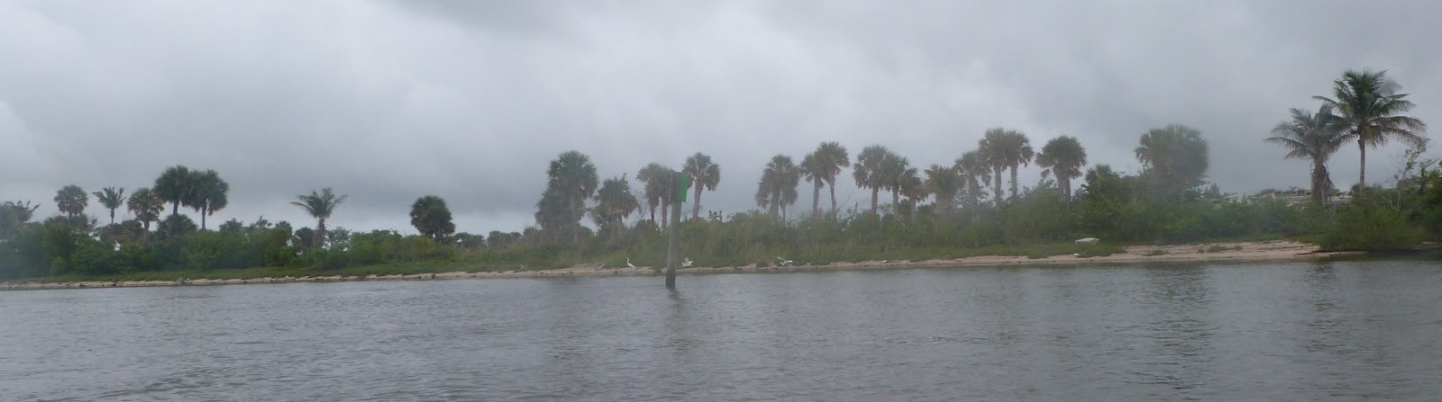
Fort Pierce has small boats at anchor - one is a canadian boat from just south of Nova Scotia. We have a brief shouted conversation as we pass and he gives me his facebook page and says to give him a call when I am up that way. The waterway here has a bit more nature than previously -


After leaving Fort Pierce we go inside - some quiet canals and waterways


We even come across some public docks - mainly used by fishermen. Later in Georgia and South Carolina most towns have free docks that can take sailboats - with timelimited access and rarely overnight stays are permitted. Actually this is not too much a problem as you can basically stop anywhere and find ten feet to anchor - as long as you not in any one's way. The waterways are actually massive - the ICW is a minor part. I had though that the ICW would be this straight line running South to North, In fact it meanders West and East,rarely going Stright north - it crosses massive numbers of rivers and esturaries - they US military engineers have created "cuts" that go from one river to another and this allows progress to be made Northwards and Southwards. A few cuts have shoaled up, particularly in Georgia where they only use federal funding. But at least Georgia has 6 - 8 feet of tide so 3 or 4 times I have to wait for high water to make the traverse across the cuts more stress free. I also set the alarm on the echo sounder and a couple of times a day have to swing one way and then the other to try and find the deeper water. It is a skill that takes some time to learn. And of course you take every bend wide - the deeper water is the middle of the channel. The river breaks out into lakes sometimes and we also see a dozen wrecked boats, either from neglect (likely) or Irma (the hurricane) I know not which.


We see vast numbers of signs about Manatees but only catch one momentary sight of a Manatee - or a big grey lump that moved. We do see Dolphins nearly every day but they are a bit slow and languid. No jumping out of the water to pose for photographs!

Shadowmere just does slow and has no wake either...

And then we move on. After Fort pierce and going up the "inside" we pass Daytona beach but don't go ashore (it is raining again) but have a pleasent (free) anchor in a lagoon behind the beach. The channel passes Cape Canaveral and had we had less draft we could have diverted into a separate canal and got much closer to the spaceport. The ICW takes into Mosquito Lagoon although a useful side effect of the rain is that the mosquitos can't fly! The lagoon is very shallow but we nudge our way off the ICW and find 9 feet of water to anchor in. Next day we find the parts of the lagoon are campsites and seem to have trailerparks with public launching ramps for fisher men. At least this part of Florida is not full of millionaires.
We head to St Augustine next and spend a day or two there being a tourist. And then onwards to Georgia and beyond!
