Martinique to Guadaloupe


We leave Martinique after diving near the bottom lefthand corner (SW if you like). Traversing the West coasts of these islands is not too difficult as the sea is calm and the winds often light. It is the gaps between the islands that get you, see above!

When we leave Martiniques southern Marina (Port de Marin) we see an infestation of yachts transmitting AIS.


The previous blog entry describes our departure and dive in more detail. After our dive we head along the 25 miles of sheltered west coast of the Island, our route will involve 25 miles of open sea and then 30 more sheltered miles along Dominica’s west coast – we skip Dominica, I hope to visit it next year as it is said to have superb diving and be a very beautiful island. From Dominica to Guadaloupe is 40 miles of open sea – at a slightly disadvantageous angle to the wind. Gentlemen prefer not to go to windward. The high tippy factor spills tea from one’s teacup. We begin with full sail as winds are light in the shelter. In the first gap the wind hits 30 knots plus and we have to drop the main to regain some notion of comfort. We were kept busy along the coasts because of a number of other vessels, all travelling along a similar track to us, or heading towards us. Inevitably nearly all traffic is up and down the coast in the Caribbean. Not all boats are on AIS and Peter and Alan see a yacht pass within a 100 yards. I observe a yacht use its spotlight to show us he has seen us and I use our spotlight on our sails and directed to him to let him know what is happening. All a bit tense. We manage to lay the west side of Guadaloupe but have to motorsail the last couple of hours to be able to reach the main town. Pointe a pitre.


We radio the marina and are told they are full. There is a carnival next week. We ask to come to the fuel dock and we take on fuel and water. I had hoped this would be handy to sneak into the office and clear in and maybe pick up Eamon. However the fuel dock is on the wrong side of a very long inlet. The marina staff come over and offer to take me over to the office to clear in, kind of them. I do this and meet Eamon who had arrived and had asked the staff about Shadowmere about 10 seconds before I radioed – spooky serendipity. So we get cleared in (online – 3 Euro) and pick up Eamon – the staff run us and his luggage back to Shadowmere. We unfortunately have to go and anchor but as we are all our tired; we eat on board, have a beer and head for bed. Next day we land Alan for his flight.


Guadaloupe has a population of 330,000 and is part of France – a full department. Agriculture and tourism feature, the latter rising in importance. Sugar Cane and Bananas feature in the agriculture front, as does the local rum. It would be nice to do a blog just on all the rums of the Caribbean. The two “islands” of Guadaloupe are joined by bridges. The two halfs are called Basse Terre (the low land) and Grande Terre (Large islands) These are misnamed, either by someone with a sense of humour, or a someone unwilling to admit and correct a mistake,. (Grande Terre is smaller and higher than Bass terre). The islands have a pleasant butterfly shape.

Then we head for Les Saintes where there are free buoys, they may be free but they are all occupied when we arrive, we anchor just south of them behind a German anchored boat but are told by port staff it is forbidden and we and the German boat must move to an anchorage which is not as sheltered – a rolly night at anchor is predicted. Actually not too bad but we visit it first and then head over to a small nearby island, its buoys are all taken and the allowed anchorages are in 12m of water but are sheltered. We head back to the 5m anchorage and anchor twice – the first time has us dragging quite fast as we are getting 30 knot gusts by now. We use the dragging anchor alarm on the chartplotter and also anchorwatch until 1 a.m we swing about but do not drag.

Here is a map, hopefully not copyrighted of Guadaloupe and Les Saintes (bottom left hand corner)


I use the MOB function on the Garmin chartplotter to track how the boat is dragging - the plot above shows that the anchor has not moved an inch - the semi-circular tracks are plots of Shadowmere swinging left and right on its chain. Which does not really suit the anchor drag alarm as it is only based on distance - the NV chart app on my phone allows a drag alarm to be either a circle or a line. But the GPS drains the battery too quickly to be useful.

Below is a bigger map of Les Saintes showing our approximate track - Alan took his satellite tracker with him so all future position updates will have to use either www.marinetraffic.com or www.vesselfinder.com neither of which is very reliable.


We see Daal 2 (and Neva) in the deep anchorage.


In hindsight the deeper anchorage is more sheltered. In the morning we go over to say hello to Daal 2 (Craig and Cressie ) but they are out freediving and we wave our goodbyes and head on to the bottom of Terre de Bas to see if a dive is possible.


In the event it is too rough and we decide to head on to the West side of guadaloupe – 10 miles of open sea await… we get a full force 8 for the first 30 minutes and a full force 9 for the next 30 minutes. On the other hand it is a beam reach and we go quite fast (with 10 rolls in the number 2 genny we easily do 6 knots in 43 knots of wind. Boat handling in a well reefed, heavy, long keeled yacht of Shadowmere’s pedigree is not difficult, and if the sun is shining it is a delight (for a short period of time anyway). Doros, Peter and Eamon helm well and earn their bragging rights in the bar. An exclusive club - Ken and Eileen are members too!
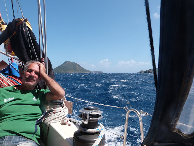


After getting in the lee of Guadaloupe’s west coast we travel up to the Jacque Cousteau marine national park which has pigeon island at its centre. No anchoring within the park but free buoys abound – all occupied when we arrive of course. We anchor off the mainland at the town of pigeon. First between two catamarans but one owner comes over and tells us there are weird swings and he was nearly hit by a motorboat two days previously. I spy a bigger gap down the coast a bit and move to it. The anchor holds and we row ashore for a meal and a beer that night.


I love those plates, and the creole food was good too – particularly the creole black pudding!
We have a walk and see a whale – bound to annoy Alan who is back at work without seeing one.
Oh – and there is a turtle there too – Alan had hoped to see one as well…


Pigeon town. In the morning I row in and get some provisions – a good French Carrefour supermarket!


The limits of the national park - the town of pigeon lurks under the middle N2 sign. The two Islands are just visible

And then we motor over to pigeon island where we pick up a yellow buoy and dive in a small bay. There are 2 or 3 dive boats keeping us company.


There are frequent rain squalls, with lots of wind. The buoy is connected with rope. It may be ropey rope so I am keen to check the mooring as soon as I can.
Peter and Doros dive first.


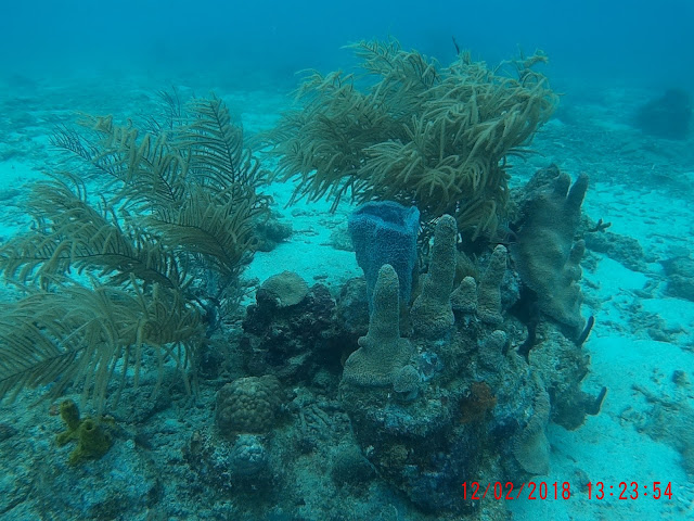
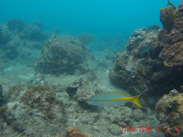
And here are some of my GoPro snaps, it is becoming clear that I should stop chasing fish for shots as invariably they race away from me - leaving me with really good shots of fish asses. Better to stop and wait for them to come back to me. Breathing out does seem to spook them so I must develop a bit more skill.


Face hugger coral I think


Lesser spotted Eamon - and my foot


Another view of the lesser spotted Eamon


The fish played peekaboo with me for ages, I couldn't get a clean shot


A ropey rope join to the mooring ring! Glad the prevailing wind would drag us to the ABC islands and not onto the rocks... in the event it held this time. Note to self, always check supplied moorings!


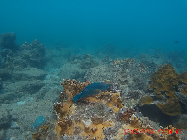


So how many varieties of fish did you see? we have good reviews of a most excellent app for fish identification in the Caribbean - over 900 species in an app produced by the Smithsonian institute. The app is 87 MBytes in size and my phone is full. To get the fish directory downloaded in addition to the actual app you need 870 MBytes of space on the phone - no chance...

After the dives we motor 8 miles up to the town of Deshaies (pronounced day-ah) which is where the TV series Death of Paradise is shot. We arrive and anchor (the free buoys are all taken). The next day we visit the bar used in the program but it is (a) closed and (b) unimpressive. The town is pleasant enough though.


We find a water taxi which saves making multiple journeys in the wee punt


Typical Caribbean town, looks more exotic in the TV series


The actual bar used in the series - on TV this looks about three times bigger!


The actual bar "La Madras" no longer opens as a bar so we retire to this one - nice views, and food.


And after a good nights sleep we leave at 6 am and head north (unfortunately Antigua is East of North and Ketches of Shadowmere's vintage do not not beat very well. we arrive at Antigua's latitude about 3 miles to the West - not too bad. However I had hoped the seas would be calm in the shelter of Antigua's south coast, they are not and we end up motor-sailing slowly for the last 10 miles and arrive in Falmouth harbour Antigua an hour before dark - just time to anchor just inside the bay.


The skipper does helm sometimes!


And sometimes shows leg - what gorgeous varicose veins. Next blog entry will be about Antigua.

Barbados to Martinique

After roughing it in Barbados we head across the sea to Martinique, we depart at noon and fly on a beam reach at 7 knots - two reefs in the main and 5 turns in the number 2. A rolly sea (of course) but we prevail and hold the beam reach, then a fine reach. Quite windy until we get in the lee of the island and we have a hour or two of motorsailing to arrive in Port du Marin on Martinique Southern coast. We had thought to arrive at daylight but came in at 5 am. Doros and I managed to pick up a spare mooring just off the marina. In the morning we motor to the fuel dock and  I clear in in at the captainaire - mainly diy using their computer, fast and painless - 5 Euro. The staff "help" us into our bow on mooring. I'd prefer to do this myself using my special swedish mooring hook but the two marina staff run around in a tizzy insisting on tying our ropes to the bouy and shouting in french to tie this and tie that. Shirley and I managed to do this in the Baltic for 5 years without much shouting but the Gallic way has more drama I suppose. Marin is very french, lovely baguettes and croissants. The marina has a lot of shops and facilities (although cold showers!) and there are a couple of laid back cafe/restaurants that serve us nicely. Alan, keen to check out the island, hires a car and we do a circumnavigation of the bottom half - the main town is Fort de France which we avoid, preferring the more "yachty" town of port du Marin.
We head for coffee and stop in sight of La Diamant - an impressive rock just off Martinique's bottom left hand corner. It has an interesting history - the English declared it a "ship" and installed cannon and sailors on it who shot at the french as they passed by. It looks like an incredible dive and we resolve to sail to it the following day.
View from the car as we continue around the coast.
We stop for a snorkel at a nearby beach, hot and sunny of course!
The wee rock is in 8 feet of water, the water is warm.


I see maybe ten species of fish and then we move on towards the North for Lunch at the Trois islets - on the south side of the bay facing Fort de France - which looks like a sizeable town (100k population)

And then we cut across to the East coast which faces the Atlantic  - it is totally different from the laid back West coast. The east is a lot poorer, buildings more ramshackle, but it has impressive water sports due to the ever present trade winds. Also has outlying reefs where I would not like to go!

The next day we depart and stop at La Diamant. Unfortunately it is blowing old boots and after an abortive attempt to anchor we conclude that discretion is the better part of valour and we will try and get a dive on the mainland in a more sheltered position... definitely want to dive La Diamant but next time will use a dive boat.

On the mainland we find two ridges and dive between them, peppered with bouys but we say only fish. Pleasant enough dive with colourful sponges, coral and fish. I dive with Alan and then Doros and Peter snorkel.


Mindelo to Barbados, across the pond.

We shoot the picture above with force 7+ winds, gusts exceeding 40 knots. The Cat above heads back after a couple of hours, they have kids on board and are new to Cat sailing - a swiss couple we had met in Mindelo. We prevail thinking it is a wind effect local to Mondelo - the nearby island has a mountain a mile high - bound to have wind effects... the stong winds last 30 miles and it is still pretty strong for two days. Yucky rolly seas make life uncomfortable. Cooking, peeing, sleeping, even staying still are an effort. <sigh> it won't be for ever...

We ready for departure aiming for Tuesday 16th January. Fuel and Water tanks full plus 65 litres of bottled water, 72 tins of beer, food from supermarket, vegetable market and butcher- we aim for fresh meat for at least the first week to be augmented by fresh fish.

Monday and Tuesday become a bit hectic and in the end we postpone to Wednesday 17th - it will still be windy for 2 days and then the grib files show benign winds for the following 14. I hope for a 16 day passage (secretly thinking we might be a few days faster) In the end we do 16 days, most of which is a sedate chilled pace, stressing neither boat nor crew. We are all over 60!

You can see grib files on www.passageweather.com, though for a 16 day forecast you need to request files direct from NOAA using email. Grib files are gridded raw data that all weather forecasts use - the direct output of the computer models for the atmosphere.

This gives me Tuesday to look at the autopilot which had a brief hissy fit on two occasions on the way into Mindelo. I discover it is unable to steer from 270 to 030 degrees - a 120 degree segment. Unfortunately we want to go West... perhaps if we headed to Patagonia that would work... In the end after stripping circuit boards that look remarkably clean for their 40 years age I conclude a very special component is faulty.  The autopilot uses a very old fashioned three phase syn-resolver technology, common in the 1960's The compass has three coils 120 degrees apart and the "knob" on the controller is connected to a three phase coil system spaced 120 degrees apart and a rotating coil. I conclude one of the coils in the knob is fubared. (google that word if you don't know it)  A spare part would be almost impossible to get even if I was home and would be very expensive. I contrive a most ingenious hack to workaround the problem. there are three wires... if I "rotate" them I can fool the compass and controller by setting the knob to the desired course plus 120. This works and off we go with the botchhackery in place.

We end Tuesday night in "Cafe Mindelo" with live music by local creole artists - fantastic guitar playing and drums. Superb quality music - would not be out of place on Jools Holland - I buy their CD.

This guy (from another restaurant) wants a tip, we tell him to scrape his tongue (not really)

 We are also treated to glasses of "grogue" a local spirit by the cafe owner - a friendly Portuguese with good English. The spirit is very spirity... <phew>
 We also try a fired sausage, diy

Next day we cash in our access cards which is just enough for a final breakfast in the floating bar at the marina. The channel between isla Vincente (where Mindelo town is) and isla Antonia runs NE-SW and clearly funnels wind. We sail under Genny alone and have a very rolly time. SW of Antonia we seem to be in a wind acceleration zone... for 30 miles. When we were preparing to leave a German sailor came up and said - "what, you are leaving?" and I think there are many boats in Mindelo who find it difficult to leave. Not as many as the boats stopped in Gran Canaria that will never leave, their dreams over, their limits met. Stay too long in a port and port rot sets in. We know the first bit will be windy but it must be overcome. To bolster our faith a couple of other boats leave with us. We sail a great circle route with adjustments every 3 or 4 days, and a few seat of the pant nudges in between - the local time noon to noon fixes are plotted on a paper chart (gnomonic projection) and this works well - we adjust clocks at the quarter, half and three quarter points and arrive in Barbados with our watches correct - Alan has uploaded satellite fixes of our position at noon UTC  - see https://eur-share.inreach.garmin.com/AlanDoyle


Of course it is hard to show big seas in photographs, the force 6 and with gusts and big rolly seas (swell coming from North, wind from NE and two different swell directions make life hell. One of our crew kindly feeds the fishes for a day but still manages his watch. We adopt a 2 hours on and 6 hours off that starts after the evening meal, Daytime watches start out more adhoc.

First meal is cooked by Peter - he heats up chilli Doros had made on the berth and we have a hot meal - important for morale! He cooks the rice by the crude McCrum method (2 to 1 water/rice, close the lid and simmer with one stir halfway through - the absorption method) rather than the Doros method with is more cordon blu but much more hassle (though much more tasty). The cook gets the last watch which means usually he gets the second watch off - reward for cooking below.


Peter caught in the act - this man can cook. He doesn't think he can, but he can.
By day 4 we are a quarter the way across and I reward the crew with a double beer ration - we had a strict one beer a day rule and when there are10 days to go, Peter springs a nice surprise of chocolate rations - he has brought 40 bars with him and we get a bar every day. Alan seems to never drink water, preferrng beer.

We amend the sail plan to fly two foresails each poled out and no main, this is easy to steer and reduces the rolls provided there is enough wind to go fast. In the lighter winds we still roll when the occasional big wave/swell hits us. but sleep has become easier - the middle portion of the journey is not that remarkable, flying fish on deck, some nights the stars are awe inspiring - 10 times more than we see at home, even in the light free parts of Donegal (which are impressive enough). The sky is infinite, we are but a tiny speck on the ocean and the sea will do what it will do and we will do its bidding. But the boat is strong, a thoroughbred, she will float.

At times I ponder that if we all fell unconscious and we had no sails up at all the boat would drift to -the far side anyway, in spite of us. We are under-canvassed but this suits us at night. The twin sails are easily reefed but even when full sails are out I observe a remarkable thing. We do 4 knots in 10 knots of wind. When the wind gusts to 47 knots, Shadowmere just quietly speeds up to 8.2 knots, still in a straight line, The only difference is that there are bright white flumes of spray flying out sideways - Shadowmere seems to be smiling in the 47 knots. These winds arrive in rain squalls although most of these arrive with no wind. We suffer progressive death of the autopilot - a new fault that is terminal. By day 10 we are handsteering - 2 on 6 off during the night and 1 on and 3 off during the day. Not too onerous with 4 crew. The autopilot is 40 years old and has had a good life... R.I.P

Getting a replacement will not be easy, it is a NECO autopilot - used by many large fishing boats and a brick shonethouse type of design. The Neco company makes motorised garage door openers now - but no autopilots. I will research what to do when i get good Wifi and can email a few people for advice. 

Anyway, the journey continues, we eat well at night, only three days of using tins (I discover Doros has a predilection for cornbeef - like my own predilection for Spam. My cornbeef patties are to die for, if you like that sort of thing. As fresh meat runs out Peter studies the fishing guides and uses the cuban reel (not related to an Irish jig) and the lures that Alan and I bought in Gran Canaria. We had three meals from Dorado.


 Doros does a nice coconut milk and thai sauce with this one

 Nearly all meals are out of bowls in the cockpit when wedged in, I serve baked fish with spuds and veg at the mid point and crack open a cool white wine. The plates stay on the table, just.
 We also encounter Sargassum weed, long streams of it - it supports turtles and flying fish. We land some seaweed to look at it.

We eat the little bladders - not too salty and quite refreshing, I hope to never have to depend on that as a source of sustenance. We see two ships shortly after leaving Mindelo and a couple more about 500 mile from Barbados. The sea is full of flying fish and weed, I see a whale, briefly, it dives about 8 feet from the boat in the middle of the night, but with a full moon. I think it was sleeping and we nearly hit it. It surfaced and blew off rather loudly, seemed close to a raspberry... Alan had heard a whale a few days previous but with no moon out he had been unable to see it. A few times we see birds - a thousand miles from dry land, amazing

Sunrise with low swell and light winds. 


The crew helming away.

Sometimes I sits and thinks, other times I just sits
Note, the beards are growing - Shirley is hoping for a calendar out of the trip.
I do fiddle with the windvane but find it works on a reach but not great on a run - it needs balanced properly and this will mean removing it. Not viable at sea.

Most of the journey has steady trade winds - I pick up a chart on the weatherfax of a low 600 mile north of us which reduces the wind strength and we have a few days of 3-4 knots of boatspeed, I suppose the SW winds of the low reduce the stronger NE trade winds. The last day we drop the poles and one of the headsails, raise the main and broad/beam reach across to the North of Barbados. There is a small port of St Charles there - a settlement of apartments and associated berths - no room for visitors, you can rent a berth - if you rent an apartment, there is also a few superyacht berths - no room for wee yachts though. I phone the port captain - at 4:30 on a Friday - the port is supposed to be open until 22:00 but he tells me he is leaving early, but will tell customs and we can stay the night on the fuel pontoon - handy enough. We get there as light fails and I get "cleared in" in about 45 minutes. The health, customs and immigration staff are all hoping to slope off early.

We celebrate our arrival in the superyacht yacht club beside the customs office.


Unfortunately Doros has since killed his beard..

We meet Craig and Cressie from Daal2 and they give us co-ordinates for a wreck dive which has a buoy on it. Over the next couple of days we anchor a mile or two south of St Charles, go ashore in the tender whereupon the surf swamps the boat with disastrous consequences for Doros - he gets wet. The surf is a curse and I wish Barbados did something to support yachts. They don't. We spend one night on ancher there and another down in Carlise bay in Bridgestown - we had hoped for a water taxi here but it was Sunday and was not to be. Alan and I brave the surf and have a beer ashore but frankly we found Barbados disappointing. The people are great, the diving is great (see separate post later) but the surf is not.

Anyway - here is a shot of Shadowmere taken from the deck of a nice wreck dive


Clearing out takes 2 hours the following Monday!
We wait to clear out as a Swedish boat is on the customs berth, we are told to anchor and for me to row in. . I cash in my last Barbados dollars by buying a small packet of crisps at 3 dollars in the yacht club. And then we are off to Martinique. A fast passage in 25 knots of wind. Shadowmere loves a beam reach!