We see these later in the Bahamas, sometimes 2 or 3 at once. They are curious about us I think. Of course they are fairly small, only 4 or 5 feet. Their mouths would only fit the smaller of my appendages...
Modern diving fashion is to hang in mid water for 3 minutes at 5 metres, presenting yourself as a tasty morsel for the denizens of the deeps.( and they call it a safety stop!!!!)

Eileen and Colin arrive at Brunswick in Georgia and my Hurricane insurance allows me to travel south the next day (November 15th). I still watch for hurricanes as the official end of the season is the 30th and some Hurricanes don't know the date...
After a couple of days travelling down the ICW, where Colin parks the boat in funny places a few times we arrive in St Augustine, a favourite town of mine. It is a lot busier than when John and I were there and many many shops have geared up for Christmas - feels a bit weird as we wander about in shorts and tee shirts.
We depart for an outside passage to Fort Pierce which goes well, the crew settling in to night watches nicely - 2 hours on and four off. Much better than when I travelled on my own when I used a 2 hours on and 4 hours on watch system
Fort Pierce allows a final provisioning and we say goodbye to Dima on his boat "Cheers", he has got his boat to Florida, mission accomplished. His parting gift was two large bags of noodle soup and beans, both adulterated with meat products (chicken and Bacon) and as Dima is a vegetarian these were not good eating for him. They are for us, lovely! thanks Dima.
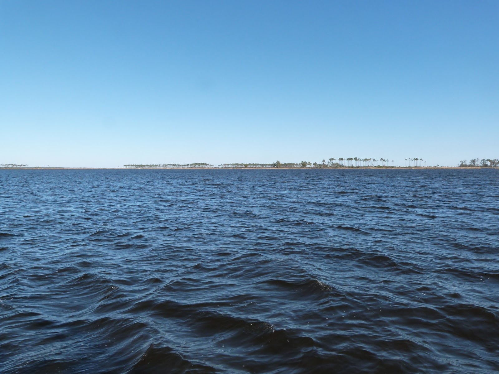
The journey to the Bahamas starts in earnest, I have decided to head down the Florida coast until Fort Worth and then turn sharp left, crossing the Gulf Stream at 90 degrees to its considerable flow. It averages 2.5 to 3.5 knots and we have a light north wind, under 10 knots. At 15 knots wind against tide the passage would be unwise, really uncomfortable a bit more wind would make it dangerous. The US government NOAA website plots the position of the stream, about 11 miles out and 30 miles wide. The light conditions make it very easy, the boat is steered 35 degrees "off course" to have us crabbing across along our track. We arrive in the Grand Bahamas in the dark at 9 pm and have to negotiate the narrow and shallow Bells channel to get into Lucaya - a few miles West of Freeport and where the marinas are. Once in the channel a basin opens up, we dock at the Grand Bahamas Yacht club, I had read that there was 24 hours customs there and we flew the yellow Q flag to signal we needed customs and immigration to clear us in. They lied.
The yacht club is like a morgue, two other boats and many empty docks, no customs until the morning, we have a beer and goto bed.

There is some life in the marina

The next morning I present myself at the customs office sharp at 8, and sharp at 9 and sharp at 10 when we get to clear in. Friendly staff, I pay $300 for the cruising permit and swap the yellow Q flag for the Bahamian Courtesy flag, we have arrived.
The Bahamas - exotic and evocative? They prove to be an "interesting" place. Tourist or Traveller?

There are many islands covering a very large area and we have to be in Puerto Rico well before December 12th and it is over a thousand miles.
Also, it is shallow, except when it isn't, you get 10 feet or 6000 feet. And the 10 feet can be 6 feet ( Shadowmere draws 6 feet 2 inches!!!) Here is the google satellite maps.

Grand Bahama Island is at the top. (GB) We next go to the very small Bimini islands (B) for a couple of dives and then onto Chub cay (C) arriving in the dark and leaving early next day to go to Andros (A) for more dives. Across the shallows to Staniel Cay (S) in the Exumas and then onto San Salvador (SS) before checking out and heading towards the Turks and Caicos Islands. The shallow parts are tagged VPN on the chart with all sort of warnings that the charts are inaccurate, Visual Pilotage Needed. In practice there are "recommended routes" and we follow these carefully whilst watching the echosounder. Funny to be out of site of (dry) land and in 10 feet of water for 10 hours.
We walk a mile to where the Lucaya marketplace and dive centre are - to glean where we might dive. The Marketplace is 43 shops selling handbags, jewellery and straw goods. And various eating and drinking places. It is for the cruise ship passengers. Buying a loaf of bread is hard. The walk there was past grass banks that were a bit untidy with litter. Buildings have cracked concrete. The market place was clean... between the coach carpark and it as well. On the way we passed a dive shop that was shut. To be fair it is out of season. We don't bother going to Freeport where there are normal local businesses apparently, Lucaya is definitely for the tourists. I have decided I am a traveller, not a tourist,
However we have some Greek food in honour of Doros and the Bahamiam beer "Kalik" is very welcome. We also move the boat a hundred yards to a hotel marina that is very cheap and has showers and a ferry to the market. If you stay at the hotel you get a beach, blue sea and blue sky, drinks and food, a swimming pool and a ferry to take you a mile and a half to the shops. What's not to like I suppose...
We take Shadowmere out and dive a wreck. The sites all have buoys and this really makes diving easy.


New swim ladder works! even for old people!!
And then it is off to Bimini where we read there is good diving.

That narrow gap is the Bell channel We see 8 feet of depth. Tidal range is 3 feet.

Eileen on watch
We anchor, sort of out in the open but because it is 10-15 feet deep the seas are low, there is shelter from the North.

After two dives (on buoys - the Bimini Barge and Hawksbill Reef) we move and anchor off the West coast, with a small reef to the North. The chart says "shifting sands and gives little depth information, I box the anchorage and anchor in the middle. Plenty of water this time! The numbers below are in feet

I have taken to hitting the Man overboard button as soon as I drop the anchor by the way. I can see how many feet from the anchor I am and whether I am dragging.

There is a small moray eel in the shot above

And a barracuda in this one. Ugly looking sneer. They very occasionally take a swimmers foot but not very often...
We move onto Andros, we didn't bother going ashore in Bimini - we invited the crew from a nearby yacht who had been ashore to come to Shadowmere for a beer and tell us all about it! Thanks Dan, Dan and Maggie. There wasn't much to tell.
And so we head over the shallows towards Andros, stopping at Chub Cay en route for rest. Chubs Cay has a very very shallow anchorage and we actually touch briefly in the middle of the night - I think there was 4 inches in it. The whole area was the same depth so there was little point in "boxing". A tight anchorage but at least we got some sleep. Chub Cay has a marina with a 5 feet entrance channel and some houses and a resort. Plots of land cost two and a half million if you fancy building something. I don't imagine there are any locals. Chub is part of the Berry Islands - at the Southern extremity.
And then a nice sail - over 6000 feet of depth to Andros. Another interesting place. No tourists! just locals! Andros "town" is across the creek from Coakly town and they have a single lane bridge joinng them. In fact Andros town is only the marina and inn, which was devastated in a hurricane and never reopened, we anchor out in the shallows between the reef and shore. The reef is a barrier reef - the third largest in the world and very deep. In fact there is a US base just down the coast and they have put up platforms on the edge of the reef with cables running over the edge to allow playing with technology.~We do the "cable dive" twice.


Shades of the Abyss - good film!
This allows us to dive the dropoff - a good dive, a very good dive but not outstanding. I think the secret is very bright overhead sunshine - I recall Doros and I in Cuba in water so clear you'd think there was no water and the sand and coral reefs were ablaze with really bright colours. Good light matters.


Closed marina and ruined docks

A flower amid the ruins


A business opportunity

We do find a place to have lunch. Water is scarce so they don't wash dishes or cutlery

We also get petrol for the outboard and compressor a mere $6.60 a gallon - and a US gallon at that (3.8L) it has been under $3 in the states

and then out the channel, passing more shut buildings


It is bad when even the church is derelict. We had met 3 or 4 locals at lunch and a couple idly fishing from the riverbank. I suppose the US military base, the diesel electric generator and the telecoms all need workers? No evidence of anything else happening.
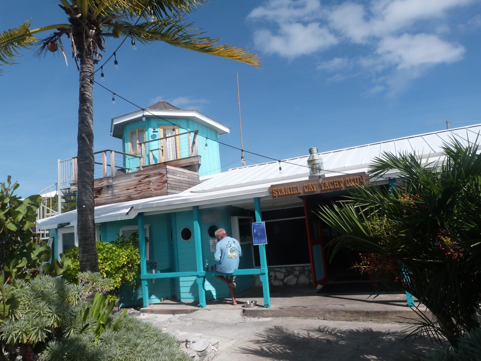
We head across deep sea to get to Staniel Cay - the last two miles is single figure depths (in feet) and shifting sands. Staniel Cay is a resort - centred around the "yacht club" which is really a bar/restaurant with attached chalets and marina. We take on fuel and move out to a buoy as the docks are reportedly boisterous in North winds and seas (active Captain App - recommended). The sea is a beautiful colour and the resort is pretty. There are also normal houses and a supermarket! as well as a local cafe/bar up the road were we eat conch fritters.

Approaching the resort
Private bits - money!


The yacht club dinghy dock is the beach!

Nice wee chalets up on the right - you get a speedboat with these! we talk to several people on the bar who holiday here - there is a landing strip and flights from Fort Lauderdale
The marina attracts the big boys, $2 per foot per night plus water charges, plus taxes plus...


And sharks - there are three in the shot above.
Staniel Cay is one of the places that the James Bond Movie Thunderball was set. Colin and Eileen dive/snorkel Thunderball cave. Actually My dad took me to see Thunderball when I was wee - it is probably the reason I took up scuba diving at Queens those many years ago - and met the love of my life - Shirley was treasurer when I joined up. Together we ended up covering 50% of all committee posts over the next four years. The rest is history. Thank you Thunderball!

After a meal in a pleasant cafe up the street and a beer in the yacht club we are ready to move on.

We eat with locals in here. Ironically we lunch in the yacht club the next day and it takes about an hour to get served. Here is much better (and half the price)
As well as local houses there are other chalets in the settlement

And the views are nice.

But they do have a working church. My new mantra is to judge places by how easy is it to buy a loaf of bread and are there good churches. (I suspect it might be a bit happy clappy but at least it is a church)

And then through a gap in the Exumas at Staniel Cay to the deeps and onto San Salvador.
I had thought of stopping in Rum Cay but discover its marina now has a sand dune in its entrance - there are yachts in the marina getting free dockage - but they cannot leave - due to Hurricane Matthew. Rum Cay has a population of under a hundred .
We go to San Salvador; poor anchorages and one marina with a "tight" entrance. I conceive a plan B if the marina is inaccessible by going on for a further couple or three nights to get to the Turks and Caicos but don't tell the crew. In the end we surf our way into the narrow entrance - there is 11 feet of water, glad the swell was only 4 feet... the next day there is no swell and we can go by dinghy to three buoys and three outstanding dives.

The marina has an American boat and we share a drink (or two) with Amy and Jay from Michigan - their 30 footer had been in a storm and they were licking their wounds before continuing to the USVI.
There are a couple of other boats but the marina is fairly empty and the hotel restaurant and Bar is shut,

Don't knock the fishing boats, a very nice man gives us fresh fish a few days later - 6 steaks each about the size of half a brick! We should get four meals out of them.
The diving (and fishing) here is very good - I think they feed the sharks here which accounts for their "interest" in humans, I had not realised that adrenaline was brown coloured until a shark stalked me whilst another was meandering in front of me. Gulp.
The island is Interesting. 12 by 7 miles long there is a Club Med - 20 people there and about 1,300 people on the island. We walk up to the Club Med but a "inclusinve pass" costs $70 for unlimited drinks, a meal and a show that goes onto 1 am. We backtrack and walk a mile into the "Town". The town has a lively cafe bar called Zippies - shuts at 9 or before if no customers. We arrive and get snapper and Salad or chicken wings and salad (and cheap Kalik beer) heaven is not always Pearly Gates and Angels you know! Amy and Jay drink with us and in the end a local offers to drive them home as Amy has reacted badly to the rum (I think). Rubber leg syndrome. The locals are absolutely lovely - caring, chatty, friendly and really genuine. I doubt the Club Med experience is as good.
There is also a noisy music bar with 12 locals. Five on their phones, three getting drunk and a poker school out the back. But everyone friendly and outgoing. A real place. I suppose the locals boarded in Nassau in their teens and came "home" there is an airport and government buildings. Not much fishing or anything? Weird. The world is a fascinating place...

This is a surreptitious photo from Colin's phone. A lady gives me a lift from the airport next day as I had gone to check out from immigration and she tells me that everyone on the island knows everyone - first names and second names. Colin chats to the local policeman who says he is bored and wants to go to Nassau where they have crime...
Finally the diving here is very very outstanding - the buoys are in 40 -50 feet of water and the stern of the dinghy is in hundreds of feet, true dropoffs at last - sharks, rays, barracudas and oodles of other fish make for a good dive, vertical drop offs, easy diving and all I could have wished for was a bit more light,
.
Colin and Eileen take a scooter around the island and get to a monument for Columbus - San Salvadorians reckon Columbus discovered America by stepping ashore in San Salvador. Hence the monument.
When?
In 1492 Columus Sailed the Ocean blue...

My conclusions on the Bahamas? - I guess a lot of people put the Bahamas up on a pedestal, the truth is your Bahamas experience will vary - if you arrive on a cruise ship or book into a hotel you will get a different experience than if you come in and wander about in the real country. I enjoyed tbe real country - the food in Andros town with the locals, the food in the cafe in Staniel Cay and the food in "zippies" with the locals who looked after Amy. What lovely lovely people.