
We leave Martinique after diving near the bottom lefthand corner (SW if you like). Traversing the West coasts of these islands is not too difficult as the sea is calm and the winds often light. It is the gaps between the islands that get you, see above!
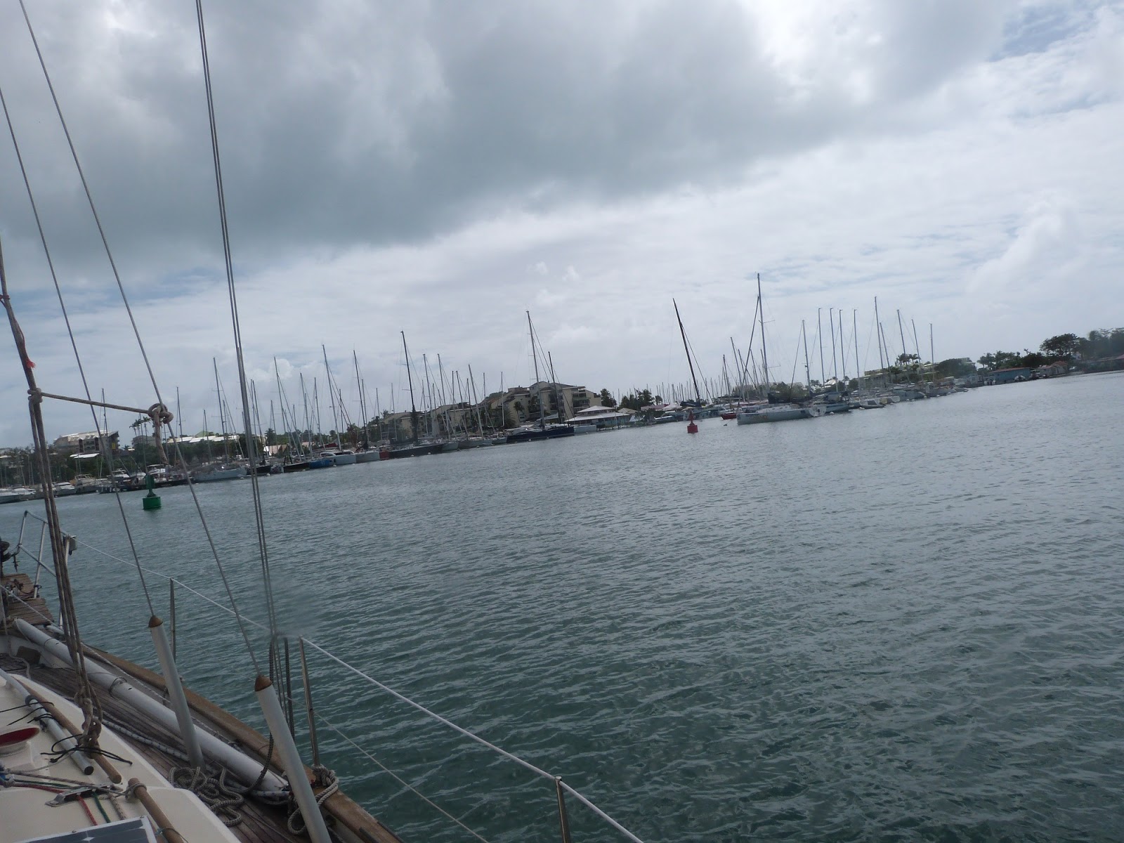
When we leave Martiniques southern Marina (Port de Marin) we see an infestation of yachts transmitting AIS.

The previous blog entry describes our departure and dive in more detail. After our dive we head along the 25 miles of sheltered west coast of the Island, our route will involve 25 miles of open sea and then 30 more sheltered miles along Dominica’s west coast – we skip Dominica, I hope to visit it next year as it is said to have superb diving and be a very beautiful island. From Dominica to Guadaloupe is 40 miles of open sea – at a slightly disadvantageous angle to the wind. Gentlemen prefer not to go to windward. The high tippy factor spills tea from one’s teacup. We begin with full sail as winds are light in the shelter. In the first gap the wind hits 30 knots plus and we have to drop the main to regain some notion of comfort. We were kept busy along the coasts because of a number of other vessels, all travelling along a similar track to us, or heading towards us. Inevitably nearly all traffic is up and down the coast in the Caribbean. Not all boats are on AIS and Peter and Alan see a yacht pass within a 100 yards. I observe a yacht use its spotlight to show us he has seen us and I use our spotlight on our sails and directed to him to let him know what is happening. All a bit tense. We manage to lay the west side of Guadaloupe but have to motorsail the last couple of hours to be able to reach the main town. Pointe a pitre.
We radio the marina and are told they are full. There is a carnival next week. We ask to come to the fuel dock and we take on fuel and water. I had hoped this would be handy to sneak into the office and clear in and maybe pick up Eamon. However the fuel dock is on the wrong side of a very long inlet. The marina staff come over and offer to take me over to the office to clear in, kind of them. I do this and meet Eamon who had arrived and had asked the staff about Shadowmere about 10 seconds before I radioed – spooky serendipity. So we get cleared in (online – 3 Euro) and pick up Eamon – the staff run us and his luggage back to Shadowmere. We unfortunately have to go and anchor but as we are all our tired; we eat on board, have a beer and head for bed. Next day we land Alan for his flight.

Guadaloupe has a population of 330,000 and is part of France – a full department. Agriculture and tourism feature, the latter rising in importance. Sugar Cane and Bananas feature in the agriculture front, as does the local rum. It would be nice to do a blog just on all the rums of the Caribbean. The two “islands” of Guadaloupe are joined by bridges. The two halfs are called Basse Terre (the low land) and Grande Terre (Large islands) These are misnamed, either by someone with a sense of humour, or a someone unwilling to admit and correct a mistake,. (Grande Terre is smaller and higher than Bass terre). The islands have a pleasant butterfly shape.
Then we head for Les Saintes where there are free buoys, they may be free but they are all occupied when we arrive, we anchor just south of them behind a German anchored boat but are told by port staff it is forbidden and we and the German boat must move to an anchorage which is not as sheltered – a rolly night at anchor is predicted. Actually not too bad but we visit it first and then head over to a small nearby island, its buoys are all taken and the allowed anchorages are in 12m of water but are sheltered. We head back to the 5m anchorage and anchor twice – the first time has us dragging quite fast as we are getting 30 knot gusts by now. We use the dragging anchor alarm on the chartplotter and also anchorwatch until 1 a.m we swing about but do not drag.
Here is a map, hopefully not copyrighted of Guadaloupe and Les Saintes (bottom left hand corner)


I use the MOB function on the Garmin chartplotter to track how the boat is dragging - the plot above shows that the anchor has not moved an inch - the semi-circular tracks are plots of Shadowmere swinging left and right on its chain. Which does not really suit the anchor drag alarm as it is only based on distance - the NV chart app on my phone allows a drag alarm to be either a circle or a line. But the GPS drains the battery too quickly to be useful.
Below is a bigger map of Les Saintes showing our approximate track - Alan took his satellite tracker with him so all future position updates will have to use either www.marinetraffic.com or www.vesselfinder.com neither of which is very reliable.

We see Daal 2 (and Neva) in the deep anchorage.

In hindsight the deeper anchorage is more sheltered. In the morning we go over to say hello to Daal 2 (Craig and Cressie ) but they are out freediving and we wave our goodbyes and head on to the bottom of Terre de Bas to see if a dive is possible.

In the event it is too rough and we decide to head on to the West side of guadaloupe – 10 miles of open sea await… we get a full force 8 for the first 30 minutes and a full force 9 for the next 30 minutes. On the other hand it is a beam reach and we go quite fast (with 10 rolls in the number 2 genny we easily do 6 knots in 43 knots of wind. Boat handling in a well reefed, heavy, long keeled yacht of Shadowmere’s pedigree is not difficult, and if the sun is shining it is a delight (for a short period of time anyway). Doros, Peter and Eamon helm well and earn their bragging rights in the bar. An exclusive club - Ken and Eileen are members too!


After getting in the lee of Guadaloupe’s west coast we travel up to the Jacque Cousteau marine national park which has pigeon island at its centre. No anchoring within the park but free buoys abound – all occupied when we arrive of course. We anchor off the mainland at the town of pigeon. First between two catamarans but one owner comes over and tells us there are weird swings and he was nearly hit by a motorboat two days previously. I spy a bigger gap down the coast a bit and move to it. The anchor holds and we row ashore for a meal and a beer that night.

I love those plates, and the creole food was good too – particularly the creole black pudding!
We have a walk and see a whale – bound to annoy Alan who is back at work without seeing one.
Oh – and there is a turtle there too – Alan had hoped to see one as well…

Pigeon town. In the morning I row in and get some provisions – a good French Carrefour supermarket!


The limits of the national park - the town of pigeon lurks under the middle N2 sign. The two Islands are just visible
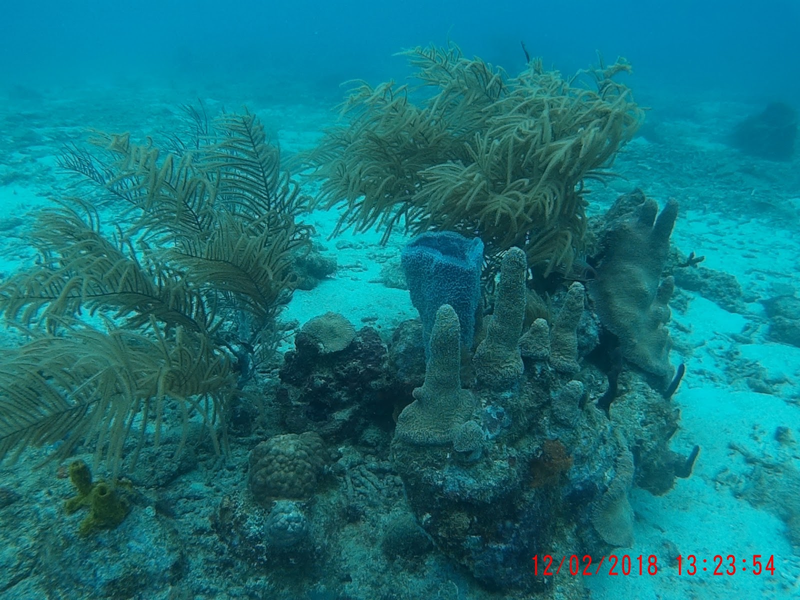
And then we motor over to pigeon island where we pick up a yellow buoy and dive in a small bay. There are 2 or 3 dive boats keeping us company.


There are frequent rain squalls, with lots of wind. The buoy is connected with rope. It may be ropey rope so I am keen to check the mooring as soon as I can.
Peter and Doros dive first.
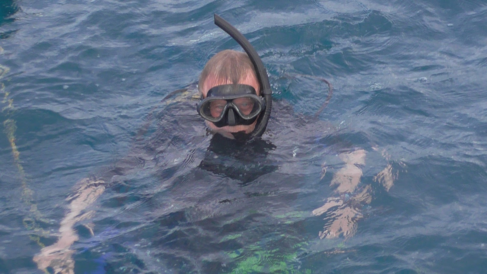

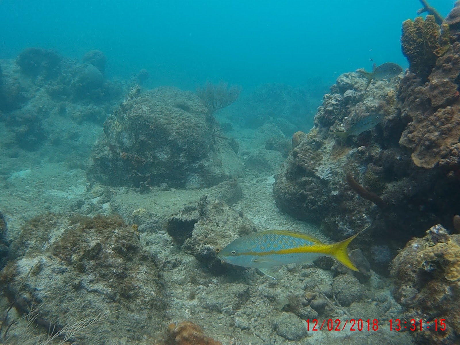
And here are some of my GoPro snaps, it is becoming clear that I should stop chasing fish for shots as invariably they race away from me - leaving me with really good shots of fish asses. Better to stop and wait for them to come back to me. Breathing out does seem to spook them so I must develop a bit more skill.


Face hugger coral I think


Lesser spotted Eamon - and my foot


Another view of the lesser spotted Eamon


The fish played peekaboo with me for ages, I couldn't get a clean shot


A ropey rope join to the mooring ring! Glad the prevailing wind would drag us to the ABC islands and not onto the rocks... in the event it held this time. Note to self, always check supplied moorings!


So how many varieties of fish did you see? we have good reviews of a most excellent app for fish identification in the Caribbean - over 900 species in an app produced by the Smithsonian institute. The app is 87 MBytes in size and my phone is full. To get the fish directory downloaded in addition to the actual app you need 870 MBytes of space on the phone - no chance...
After the dives we motor 8 miles up to the town of Deshaies (pronounced day-ah) which is where the TV series Death of Paradise is shot. We arrive and anchor (the free buoys are all taken). The next day we visit the bar used in the program but it is (a) closed and (b) unimpressive. The town is pleasant enough though.

We find a water taxi which saves making multiple journeys in the wee punt


Typical Caribbean town, looks more exotic in the TV series

The actual bar used in the series - on TV this looks about three times bigger!


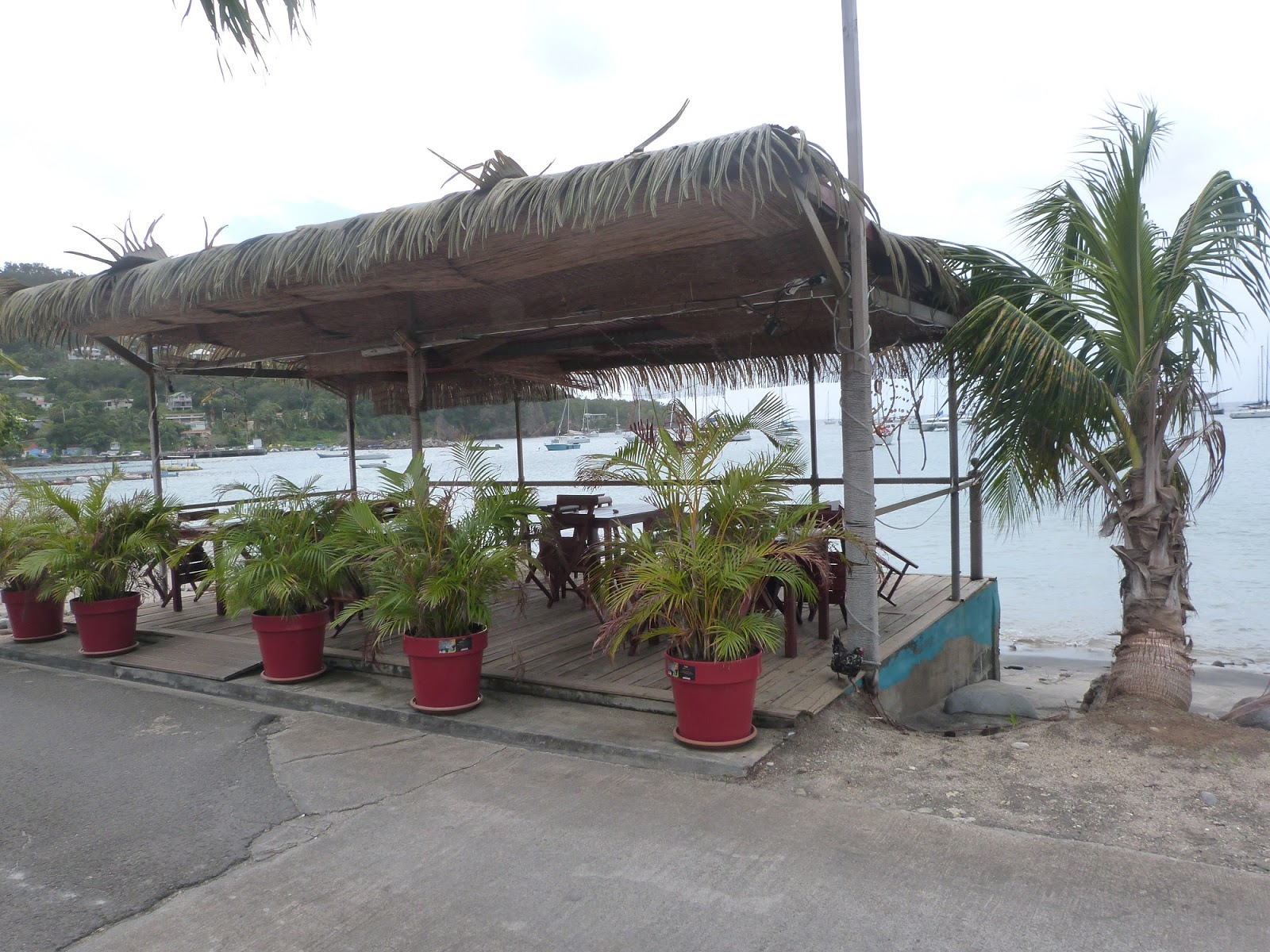
The actual bar "La Madras" no longer opens as a bar so we retire to this one - nice views, and food.

And after a good nights sleep we leave at 6 am and head north (unfortunately Antigua is East of North and Ketches of Shadowmere's vintage do not not beat very well. we arrive at Antigua's latitude about 3 miles to the West - not too bad. However I had hoped the seas would be calm in the shelter of Antigua's south coast, they are not and we end up motor-sailing slowly for the last 10 miles and arrive in Falmouth harbour Antigua an hour before dark - just time to anchor just inside the bay.

The skipper does helm sometimes!

And sometimes shows leg - what gorgeous varicose veins. Next blog entry will be about Antigua.